top of page

Community & Environmental Planning Technician
Remote Sensing Technician
Katie Chute
 This is the Proposed Engineering Plan Book that was created for AutoCAD Civil 3D course. This plan book takes all the plans, that I have worked on all semester and put them together with all the corrections done. |  In creating this drawing a surface dataset was imported, which then was used to create a road alignment and to display contour intervals for the Delusion Park Subdivision location. Another dataset was imported, that data was used to display the boundary for this location was used to show the extent of this location, the road and also the stream that runs through the property. The road alignment was then created by using coordinates that were provided. |  This drawing shows a profile for a proposed road alignment for the Delusion Park Subdivision. The goal in creating this profile was to reduce the amount of cut and fill that would be required for building this proposed road. A portion of the profile and the section of the road alignment that goes with the profile is what is being displayed in this drawing. |
|---|---|---|
 This drawing shows the road corridor for the Delusion Park Subdivision proposed road. |  This drawing shows the information from the report. This drawing also shows a section view that was built by first generating the sample lines across the alignment itself. Then by selecting these lines the section views were could be created. This section view displays the surface volume information from the proposed corridor surface. |  This drawing shows the parcels that have been created by using the new ground surface that was created. The alignment of the stream, which was running across the proposed subdivision, has been created and also a right of way has been created along the stream and proposed road alignment. |
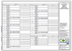
 This drawing shows length, angles and directions information in a table format alongside the corresponding labels. |  This drawing shows a proposed rain garden for the Delusion Park Subdivision, the rain garden was created using the finished ground surface set to display at 0.25 meters and 1.25 meters. The elevation of the pond was changed to 91 meters for a better runoff and the grading was done to make sure that the bottom of the rain garden was even and the top outer edge was flat so no water could pool. |  This drawing shows a storm water pipe network proposed for the Delusion Park Subdivision, located at the uppermost slope of the proposed road. This will drain the surplus water down into the headwall. |
 The tables shown in this drawing show two different sections. The tables named Storm Phase 1 goes with the network that runs along the proposed road alignment and Storm Phase 2 goes with the network that runs from the proposed road alignment to the proposed rain garden. |
bottom of page